 Loading...
Loading...
Loading...
Create personalized walking experiences
Go Street is a mobile application for urban street walking index measurement and navigation. It involves transforming and applying big data from the streets and surroundings to people's daily lives. It is designed to create novel experiences of walking navigation that help people effectively get the street information tailoring to their own preferences, and complete the corresponding social, entertainment, travel, and sports activities.
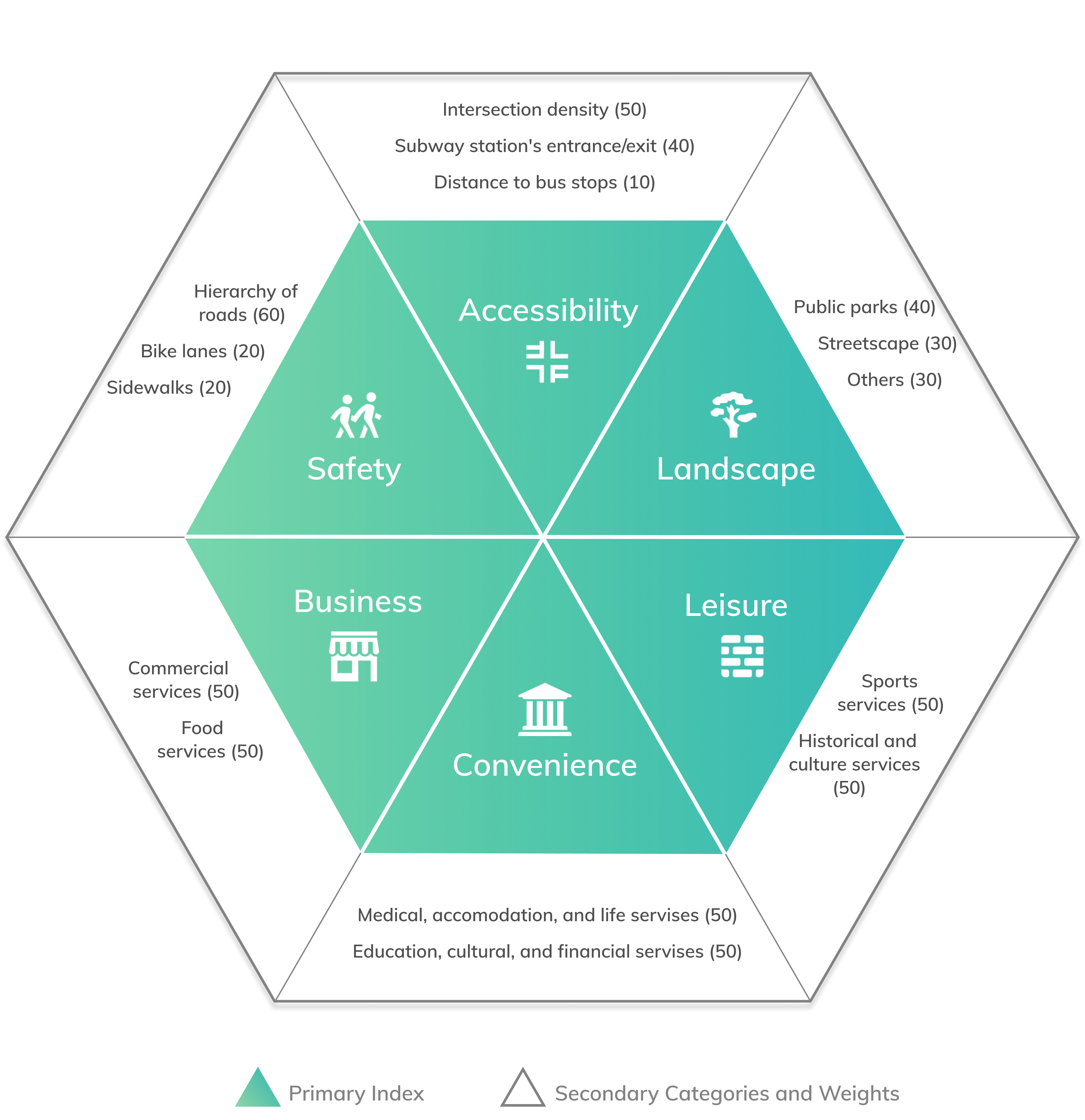
6 Index + 6 scenarios
Urban+ is a startup in China focusing on using data-driven navigation systems to provide users with innovative street experiences. Having Ningbo Haishui District as a start-up pilot project, Urban+ has completed the basic POI data acquisition work and developed six walking index experience evaluation systems. The Go Street app aims to increase the viscosity of users to accumulate sufficient walking data and samples, then inform the decisions under government-faced and business-faced scenarios.
Are we able to make the walking experiences predictable as road congestions?
How can we transform the current indexes and data to meet user’s scenario-based and personalized needs?
Although Urban+ has developed the six indexes to evaluate the walkability of the street unit, it is less meaningful for individual user to comprehend the indexes and link them with their walking activities. Walking is a huge topic that covers everyone’s daily life. As designers, we need to conduct the research from the very beginning to figure out the target users who care walking experiences most as well as the design strategies to enhance both online and offline experiences.
Why are we doing this? What is the market coverage of the product?
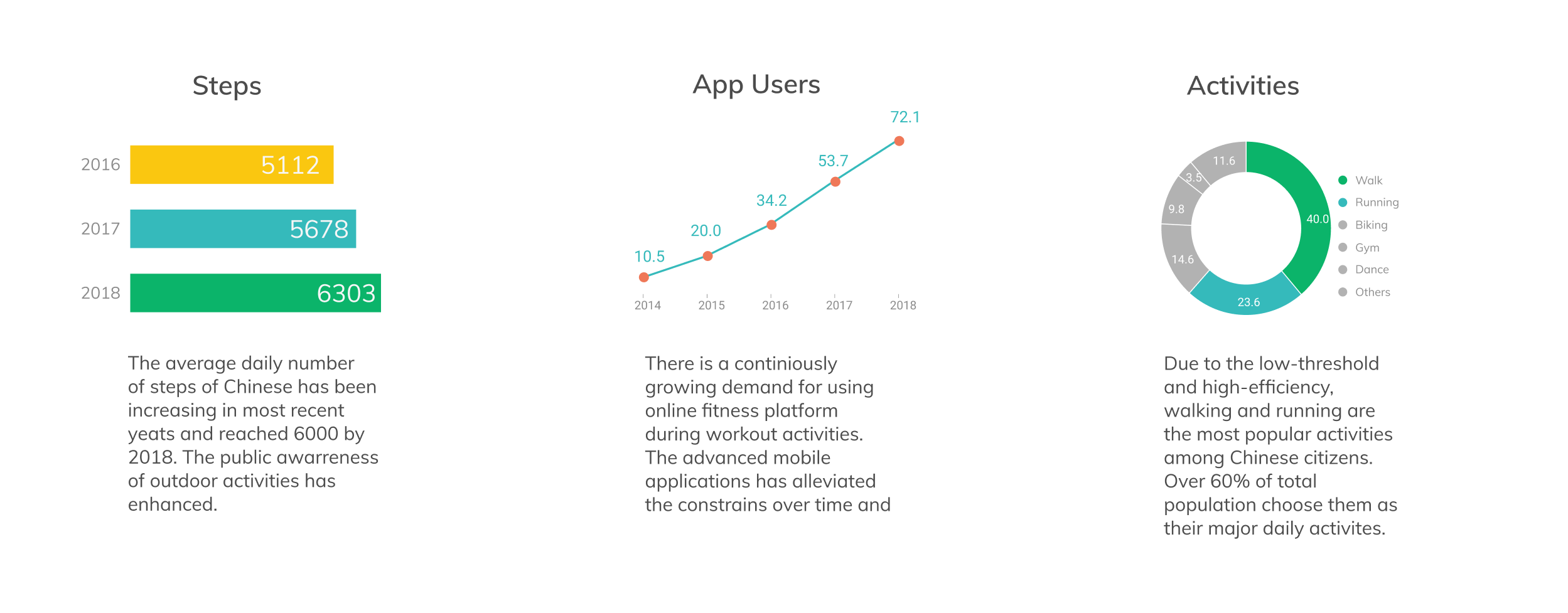
We looked at the contexts and trends related to walking activities of citizens in China. Under the background of the new infrastructure, the national health awareness and urban humanization, citizens are becoming more inspired to go for a walking outside. Research data shows that walking and running accounts for a large population base (60%) among all the outdoor activities in China. The demand for daily walking activities and the demand for app-assisted traveling/sports activities are also increasing year by year.
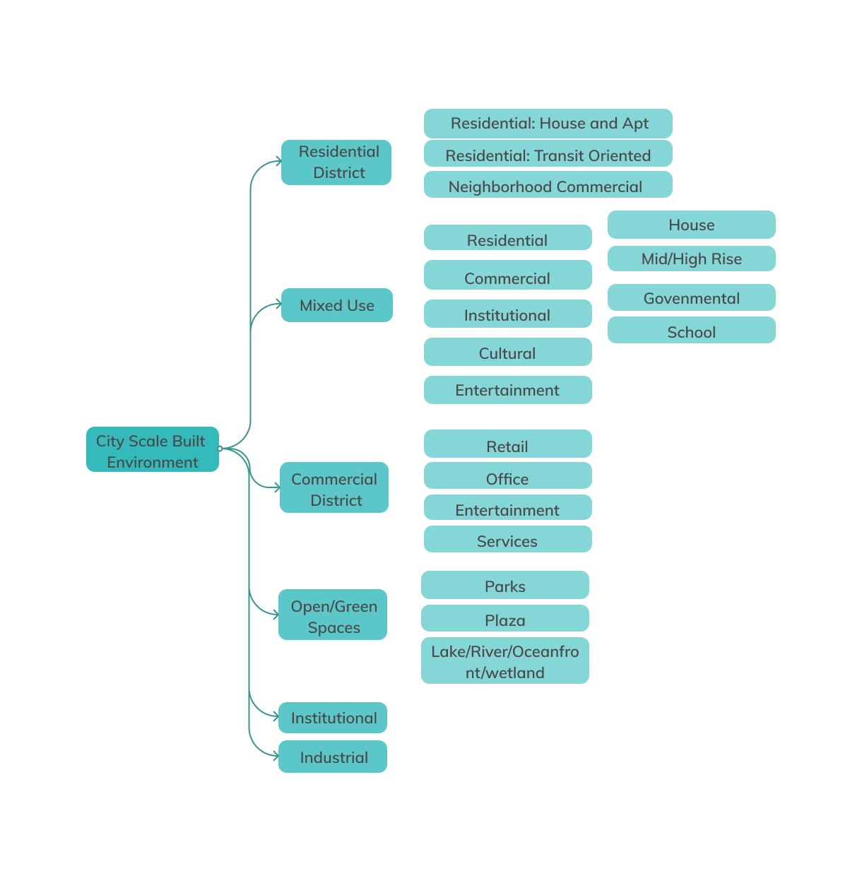
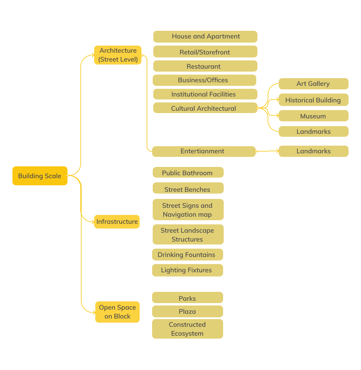
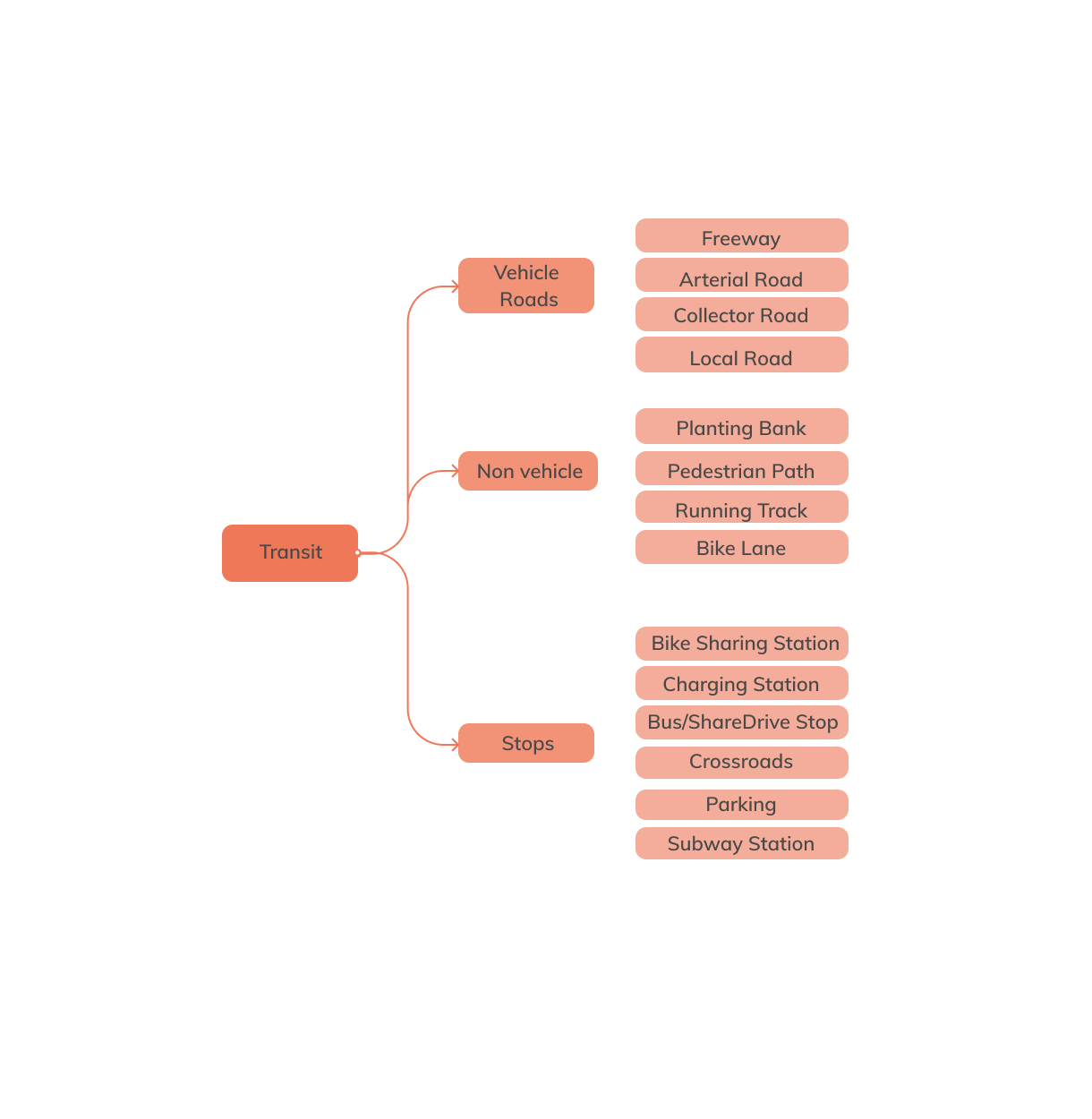
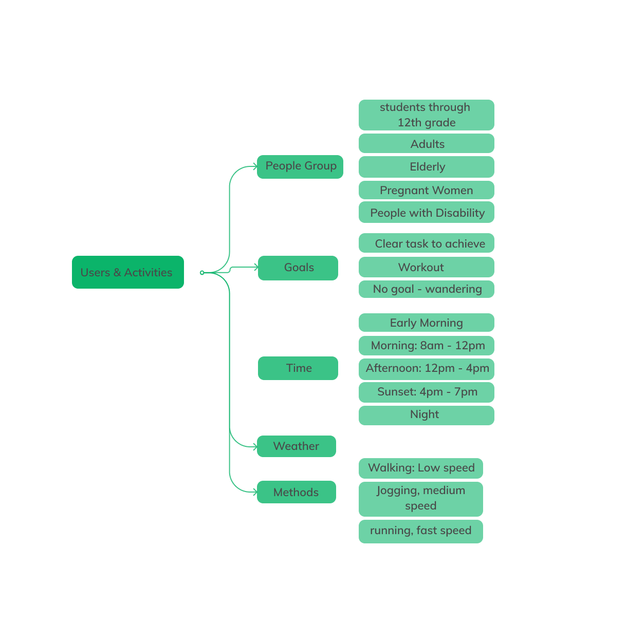
What are the factors that influence the walking experience? How can we break down and categorize the functions covered in streets?
Through the study of different urban spatial types and urban functions, we explored the factors that can affect how people evaluate their walking experiences. In addition to that, we also divided users and activities into different categories to look at people's demands and expectations while walking.
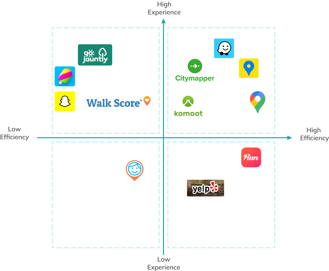
What are some novel designs for navigation Apps in the world? What can we learn from them?
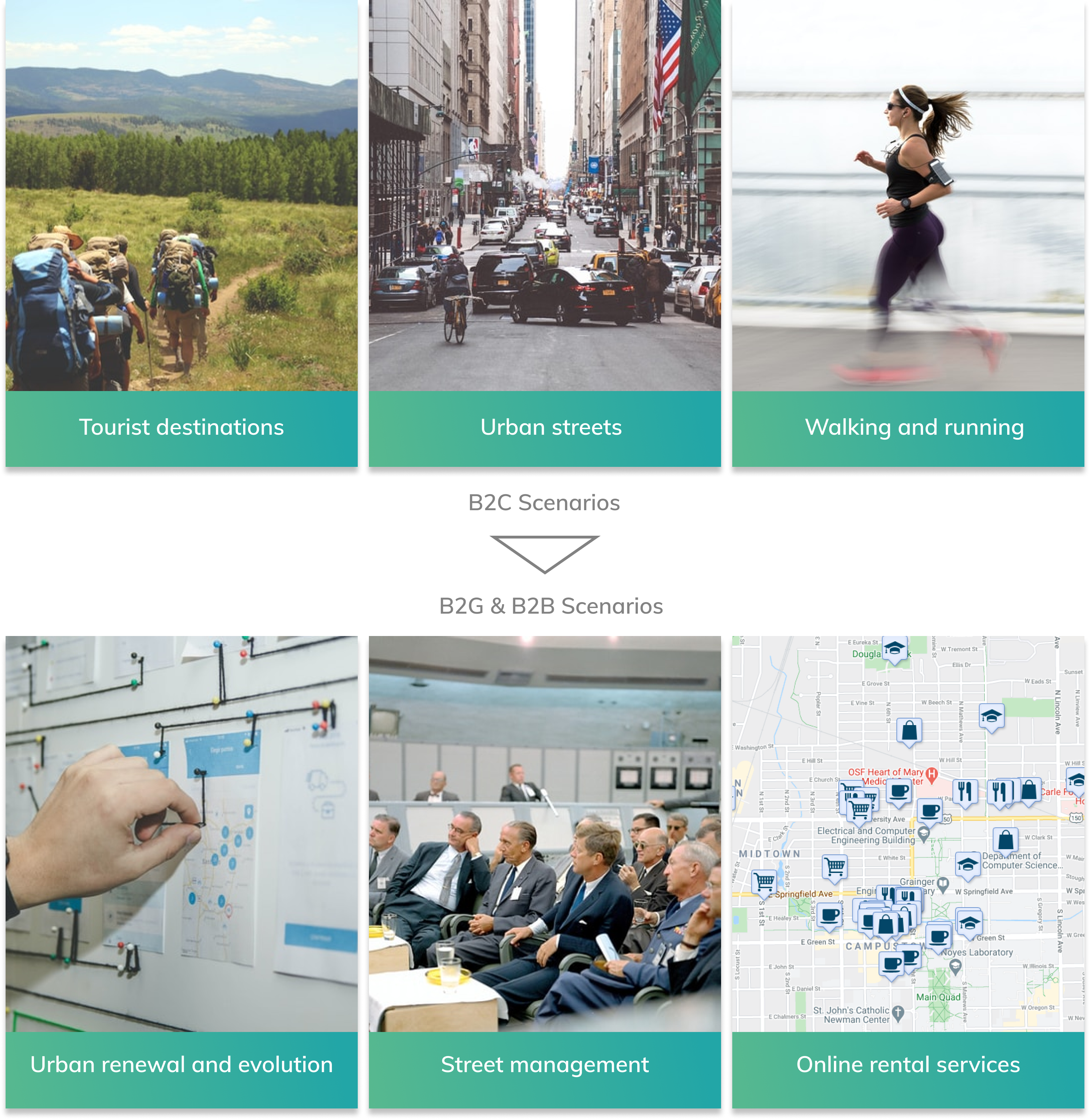
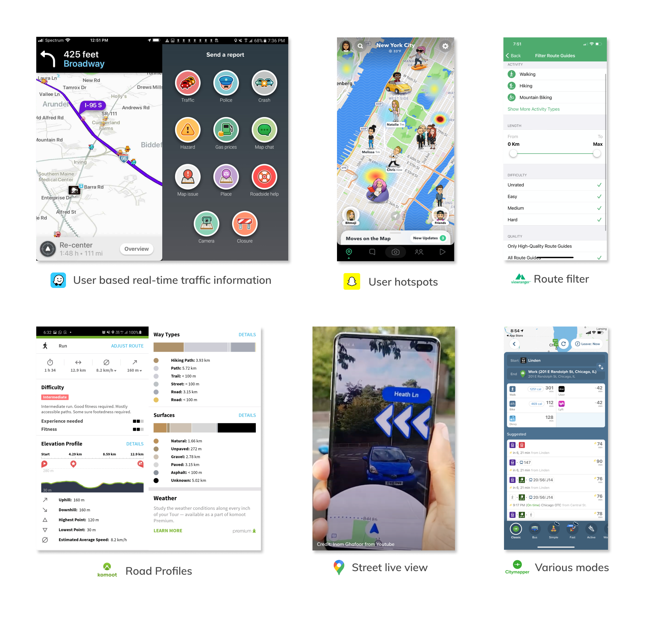
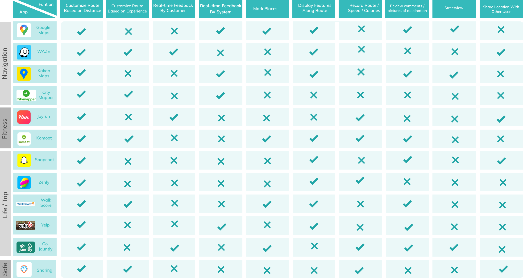
Currently most of the mainstream navigation apps are designed for driving, with the aim of completing the commuting activity in the shortest possible time. There are also other apps focusing on navigating for users that have demands for outdoor exercises. These cases provide us with useful insights, especially the information that people pay attention to outdoors and the feedbacks they expect after walking. These contents vary according to the specific scenarios of the product. For instance, Snapchat creates social opportunities by displaying friends' real-time locations and hotspot contents on its navigation map, while komoot offers the most detailed road information as possible to help users get the most intuitive sense of the road conditions and plan for the hiking and road cycling activities.
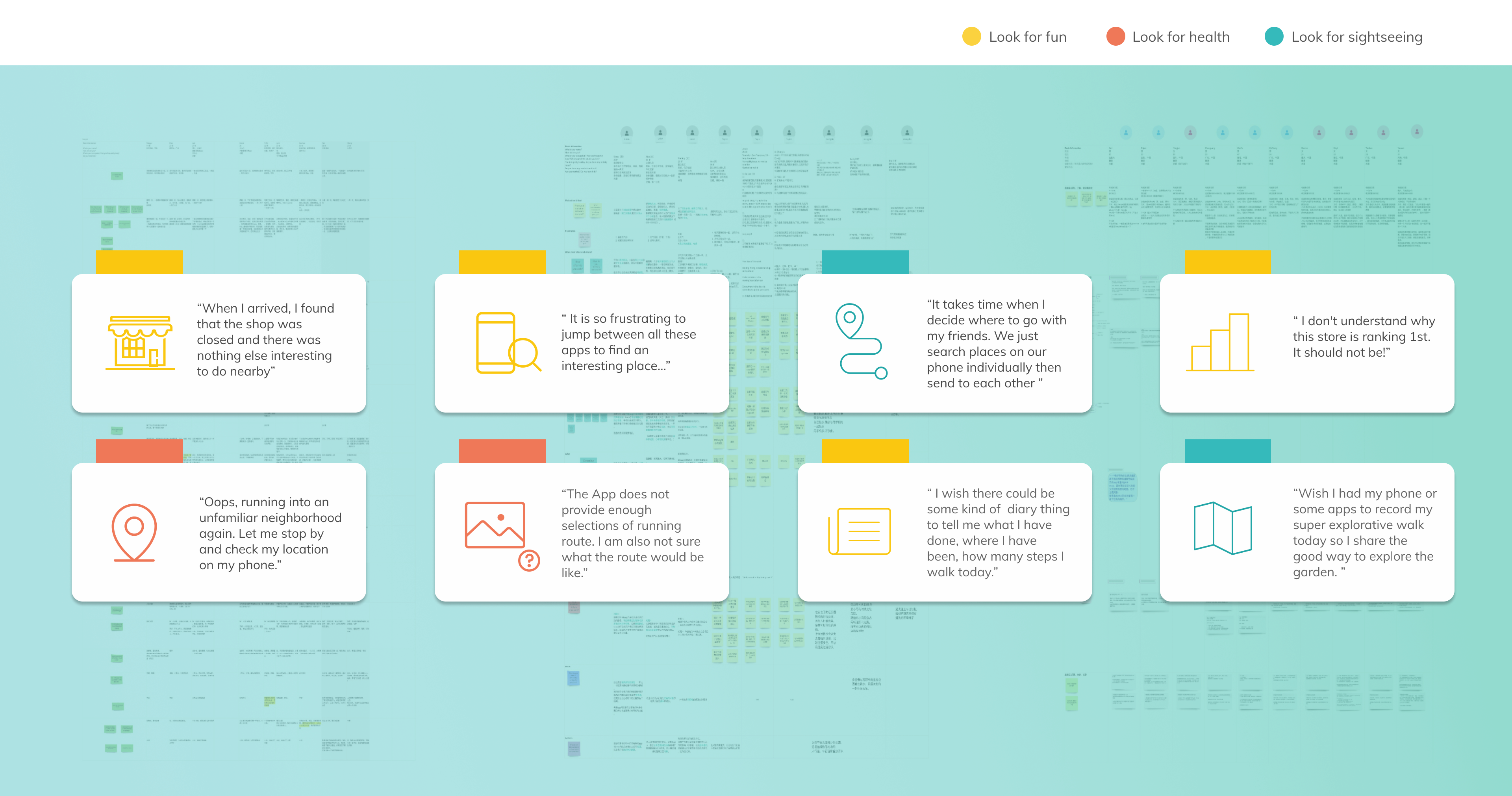
Uncover people’s needs in different stages of walking activities
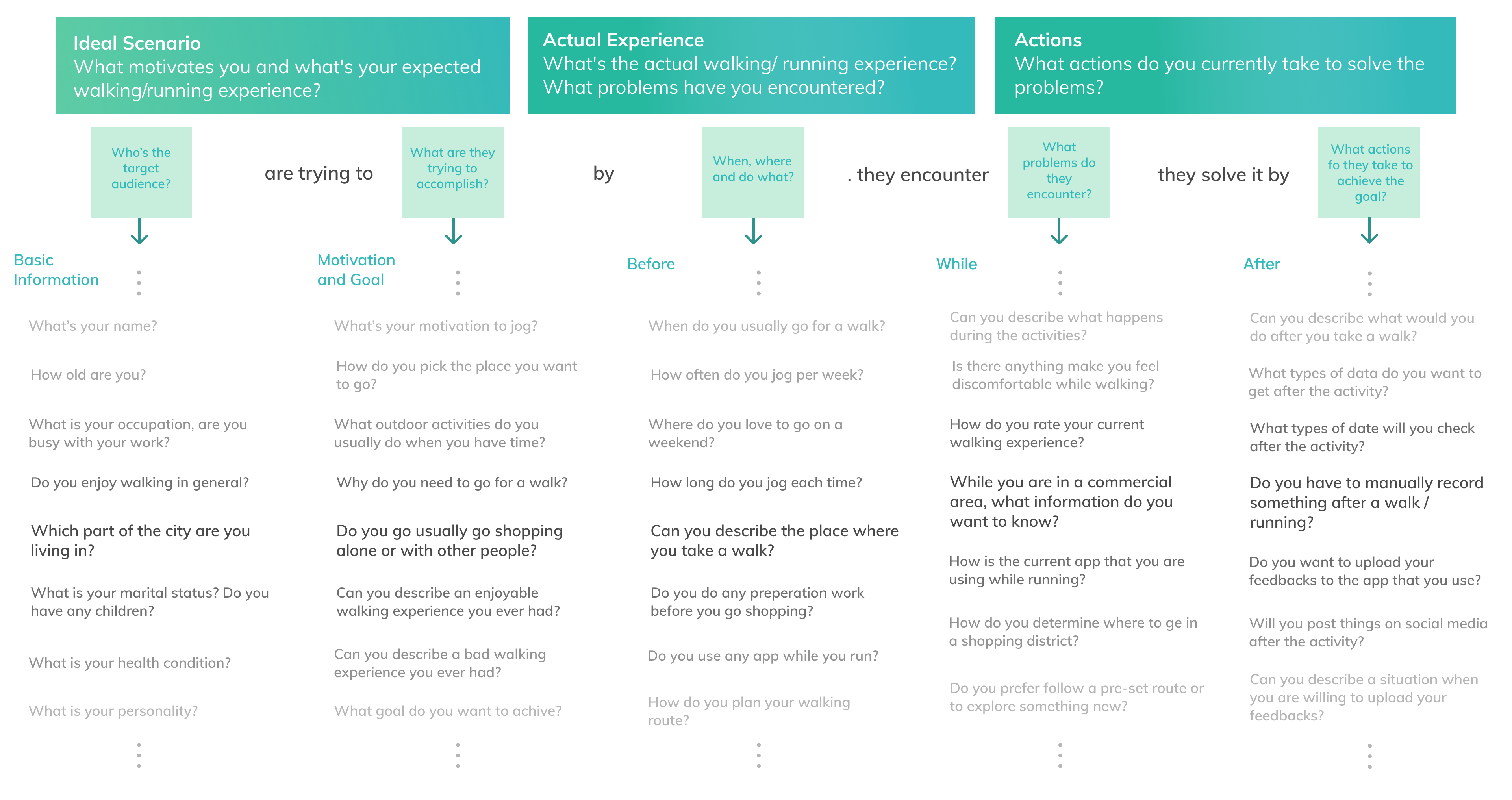
There were 30 respondents participated in the interview. The interview aims to understand our users’ current behaviors, needs, and motivations during walking activities. The core interview questions cover the user’s basic information, goals, walking contexts and conditions, emotions, as well as their current solutions if encountering problems.
Interview Questions
User groups and important quotes
Among these interviewees, we found that using the goals of walking to distinguish user groups is the most intuitive way, because the user's behaviors and the way of evaluating the street environment will be clearly distinguished based on their motivation to go out. According to the motivation of walking activities, users are mainly divided into three types, they are: fun-oriented shopping activities, health-oriented running and walking activities, and scenic viewing-oriented traveling activities. We abstracted users' key feedback to reflect their corresponding needs and pain points.
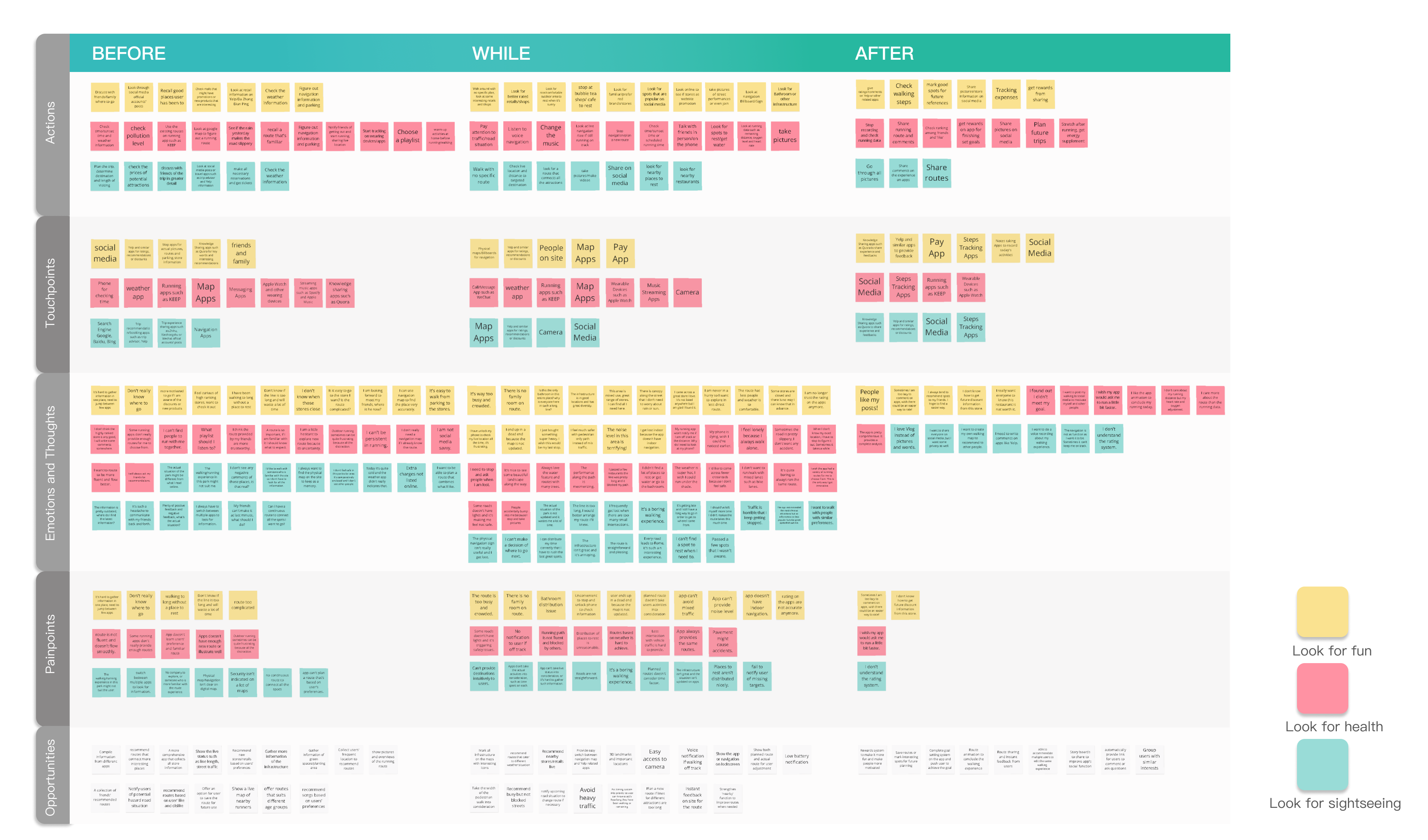
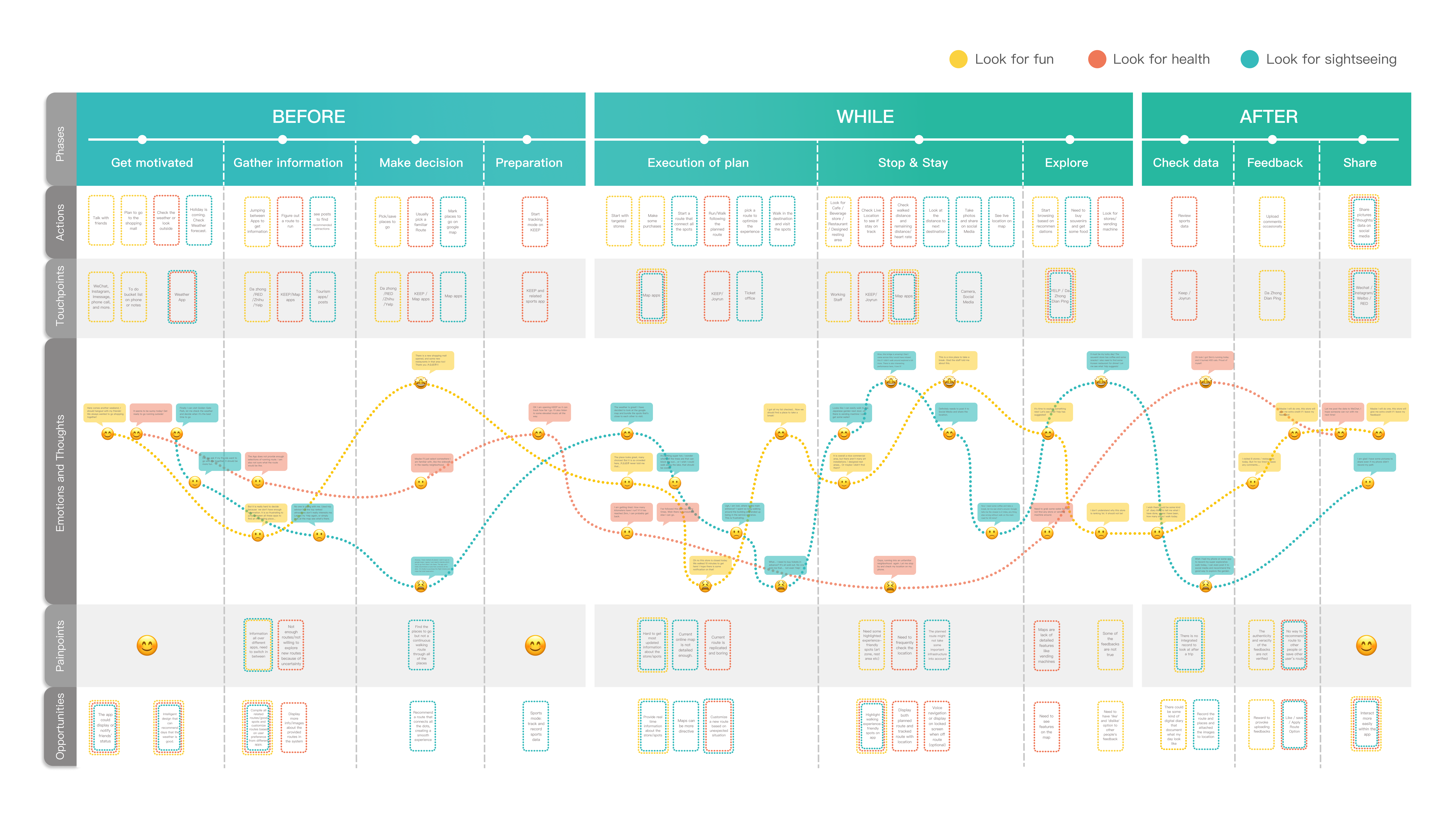
Experience maps depict user interactions
After dividing the user groups, we start to put raw information from the interview on the experience maps which depict the actions, touchpoints, emotions of different groups in the three stages of walking activities. It illuminates holistic user experiences to help us further prioritize pinpoints and uncover opportunities together.
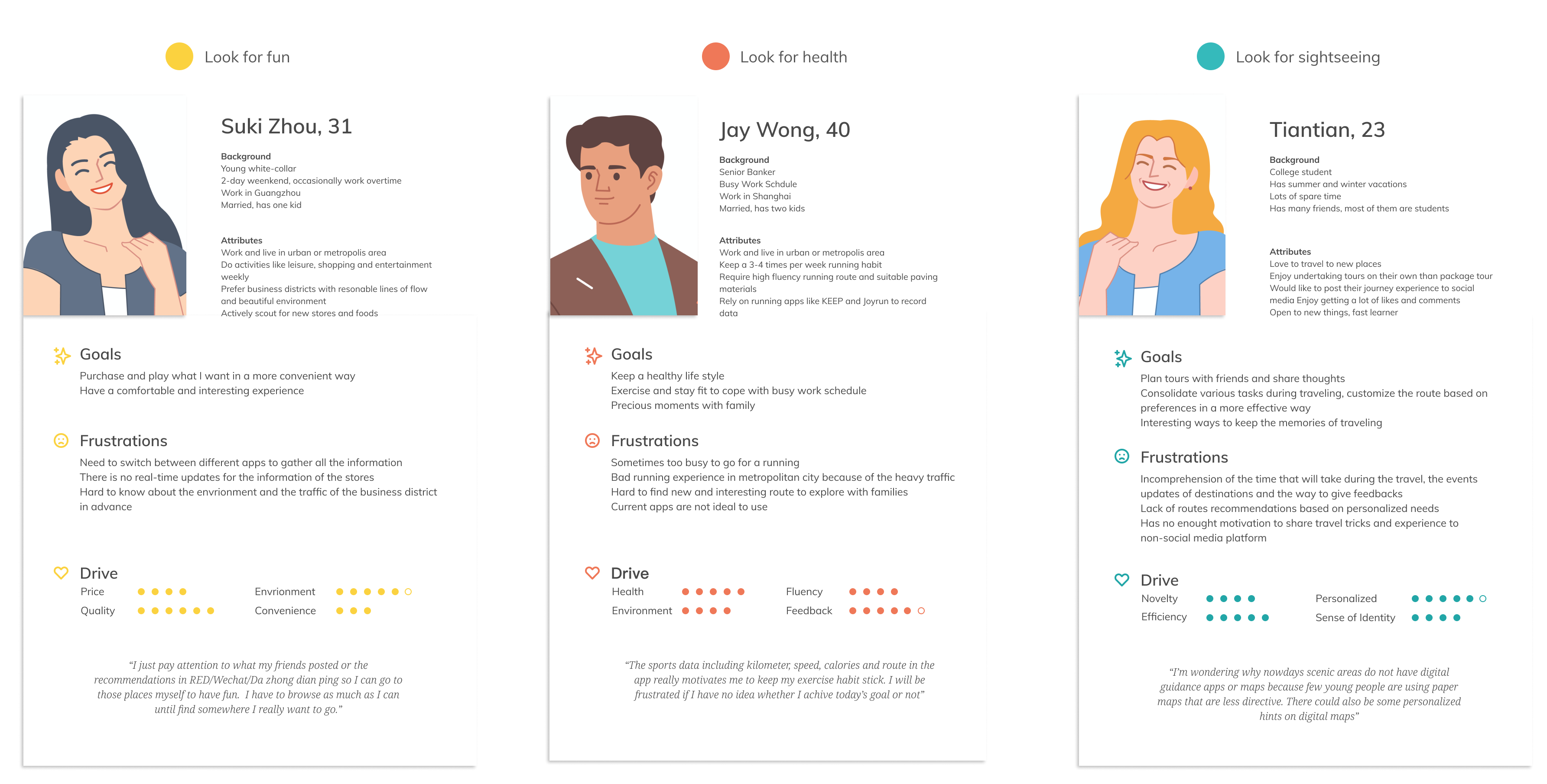
What attributes do they share? What qualities differentiate them?
On the basis of the interview results, we identify the target users as young and middle-aged with some experience in using mobile applications to inform decisions of outdoor activities. Their biggest attribute in common is that they like to go out and socialize, or get involved in shopping, traveling, sports activities. Their drives to decide where to go differentiate them from each other.
How can we develop synthetic strategies to fix the main pain points?
We further divide the stages of walking into more steps. We summarize the raw data from experience maps into concise phrases so we can clearly describe what happens at each stage of the interaction and see the common needs embodied by all the user groups.
Turn business-centric objectives into customer-centric features
From the perspective of Urban+, the end scenario to be achieved is to collaborate with regional governments to ultimately hail a big advance for sustainable urban evolution. What Urban+ expects throughout the entire product cycle is the collection of walking data metrics, which enables the team to keep updating and refining the walkability evaluation system. After the product increases customer stickiness through referral traffic, it is expected to build street-based virtual neighborhood and create a new street lifestyle. Furthermore, the sure thing, Urban+ needs to figure out the business model for generating profits. Finally, we identify that the sweet spot to achieve is to adopt features in the following illustration to build an effective feedback loop between stakeholders.
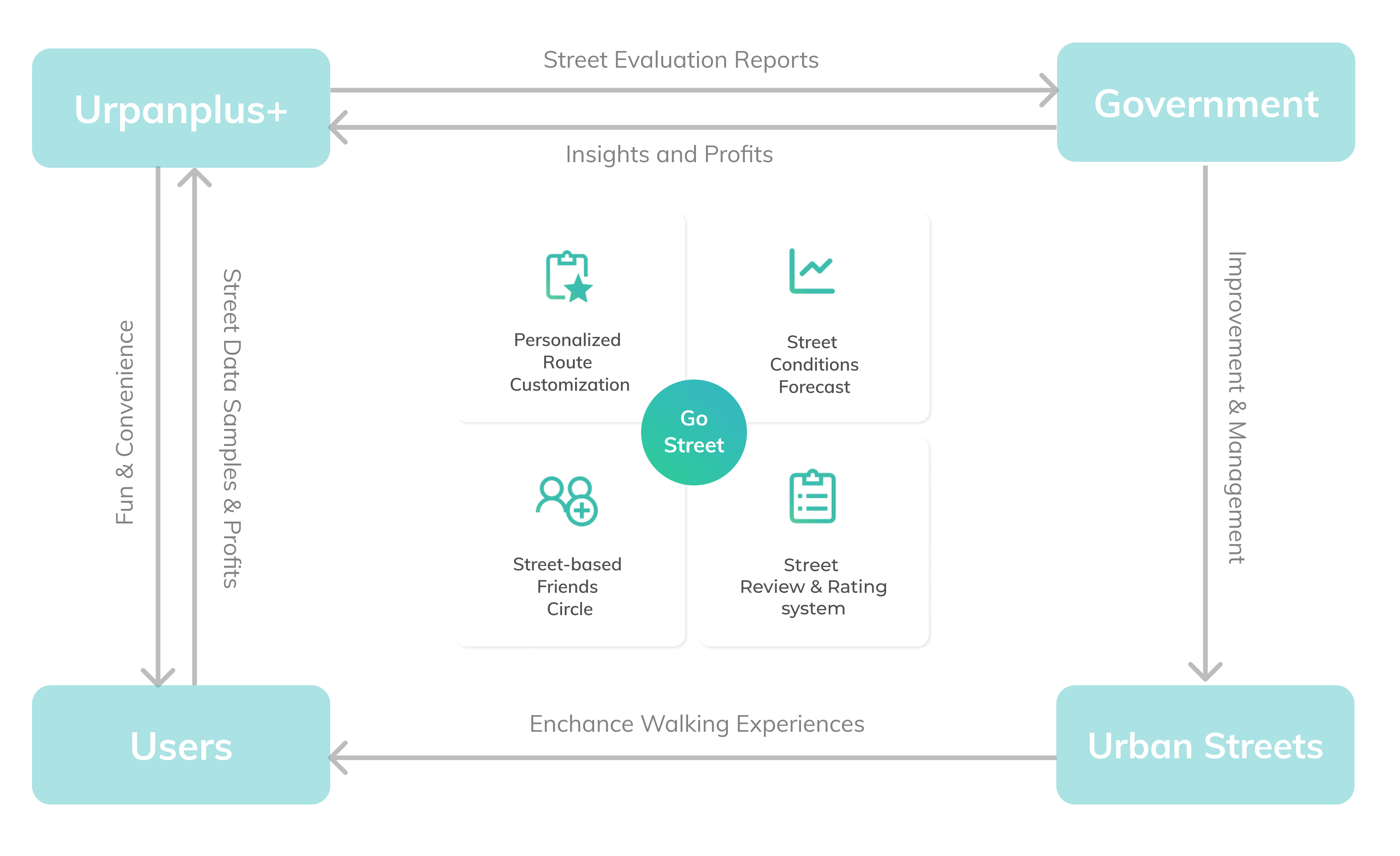
Product Vision
Bring team together brainstorm to find out best solution
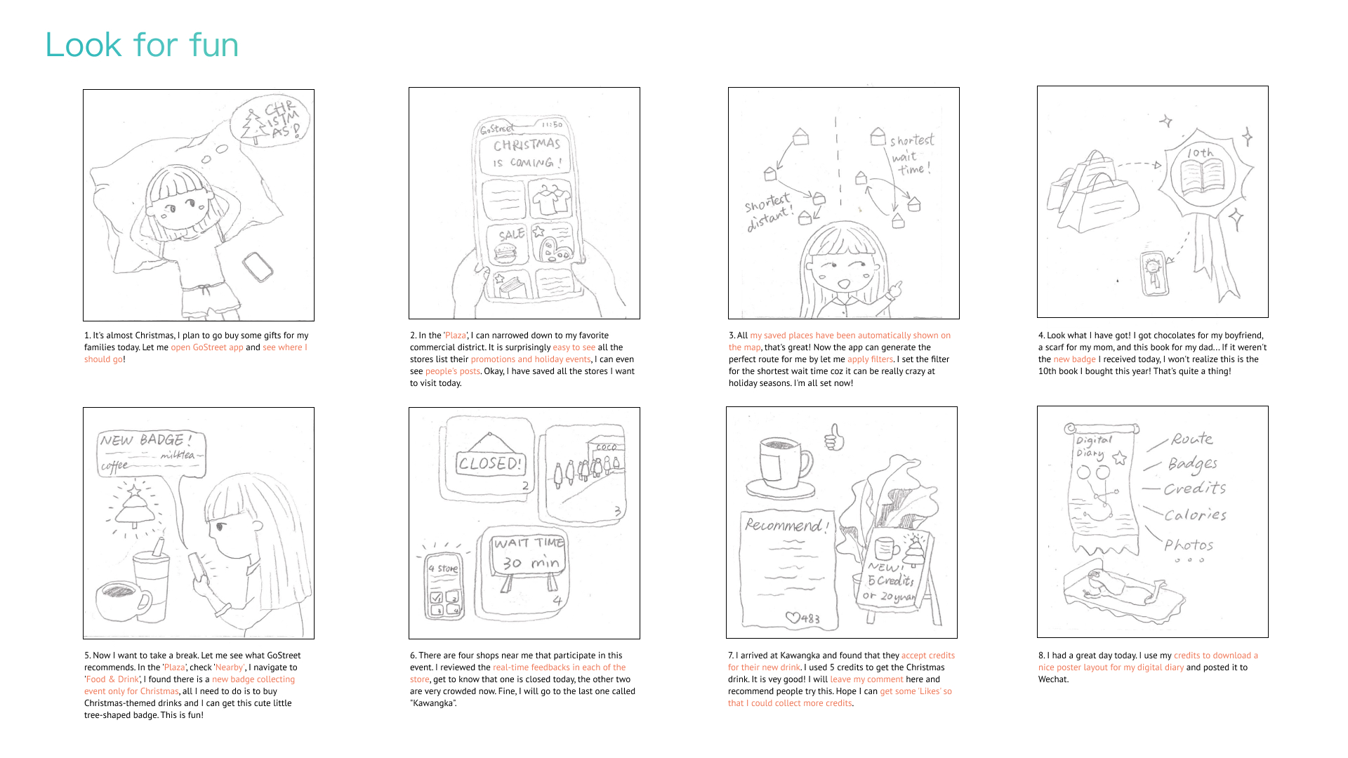
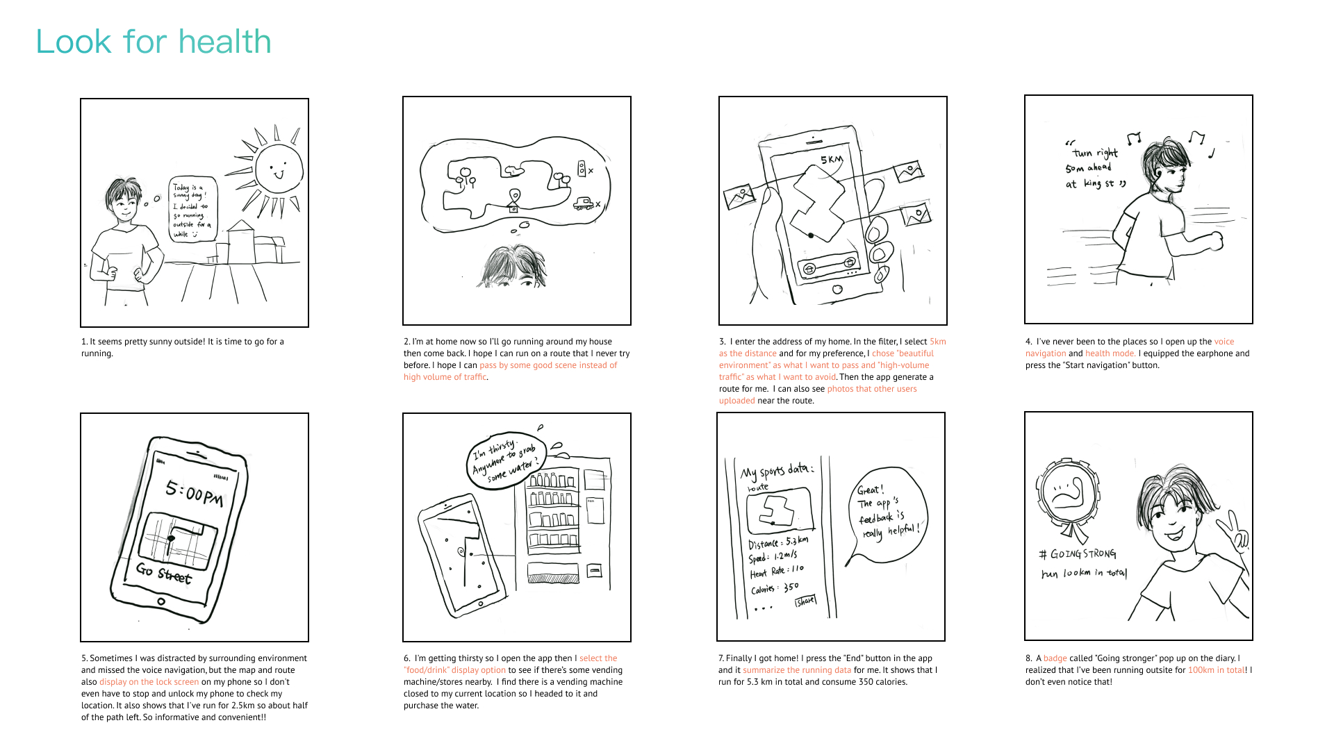
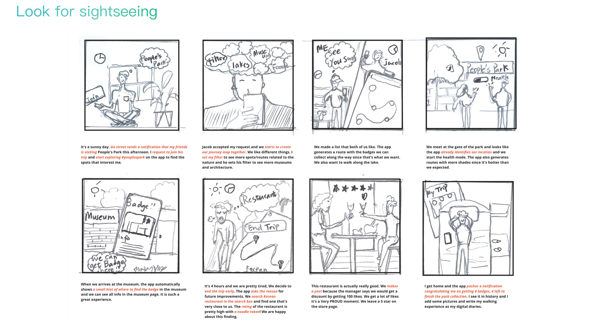
After being sure that our team is on the same page of pain points and goals, we work individually to generate solutions then work in group to synthesize ideas. Each of us then picked one persona and generate storyboards that chronologically maps the main events.
We then collaborated to draw low-fidelity interfaces using Miro board, discussed and debated on these ideas to achieve syntenic thoughts.
Iterations all the time
Through all the design process, we had weekly meetings with stakeholders including the CEO, experience design consultor, prduct manager and developers. We also invite users to go through our design to share their thoughts and concerns. The iterative feedbacks help us to keep narrowing down the design strategies and focusing on the target users as well as the minimum viable features.
The iterations we made before we got into the high-fidelity design phases including:
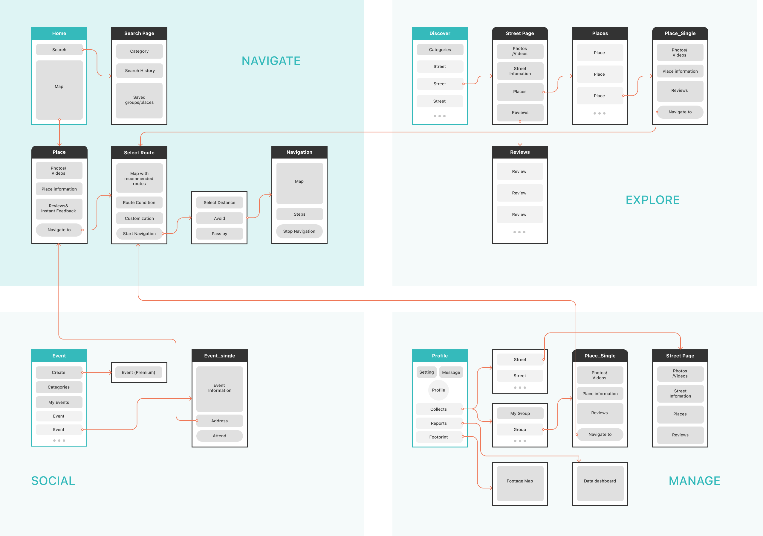
Information Architecture
The app uses bottom navigation to display four main destinations that respectively represent the goal of navigation, exploration, social and profile management. The homepage navigation provides the core map-based services to help user select a route towards the destination. Discover page displays recommended nearby streets to explore. Through searching and viewing preferrable streets or places, users can always quickly access to the interactive map and navigation feature without switching between different tabs.
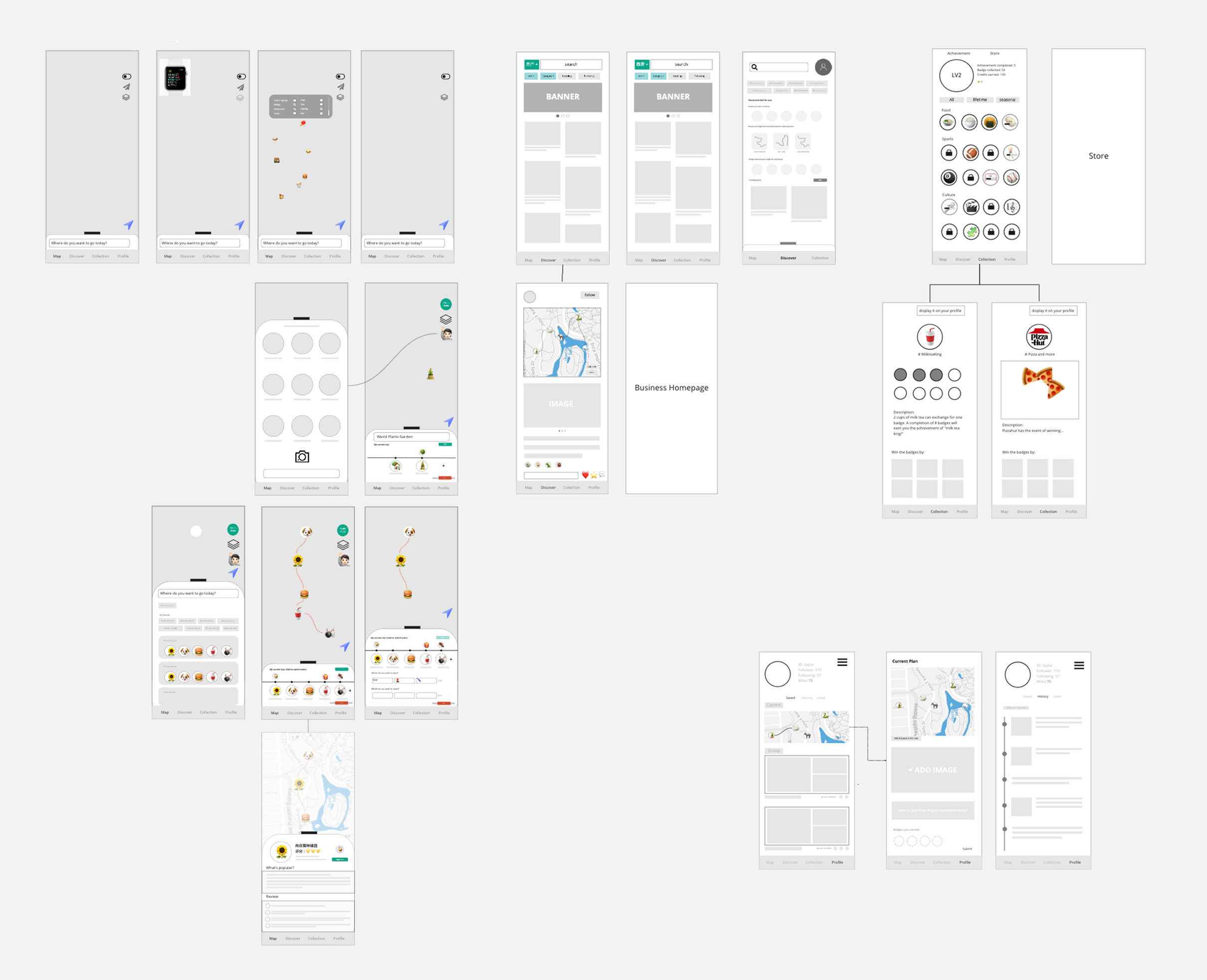
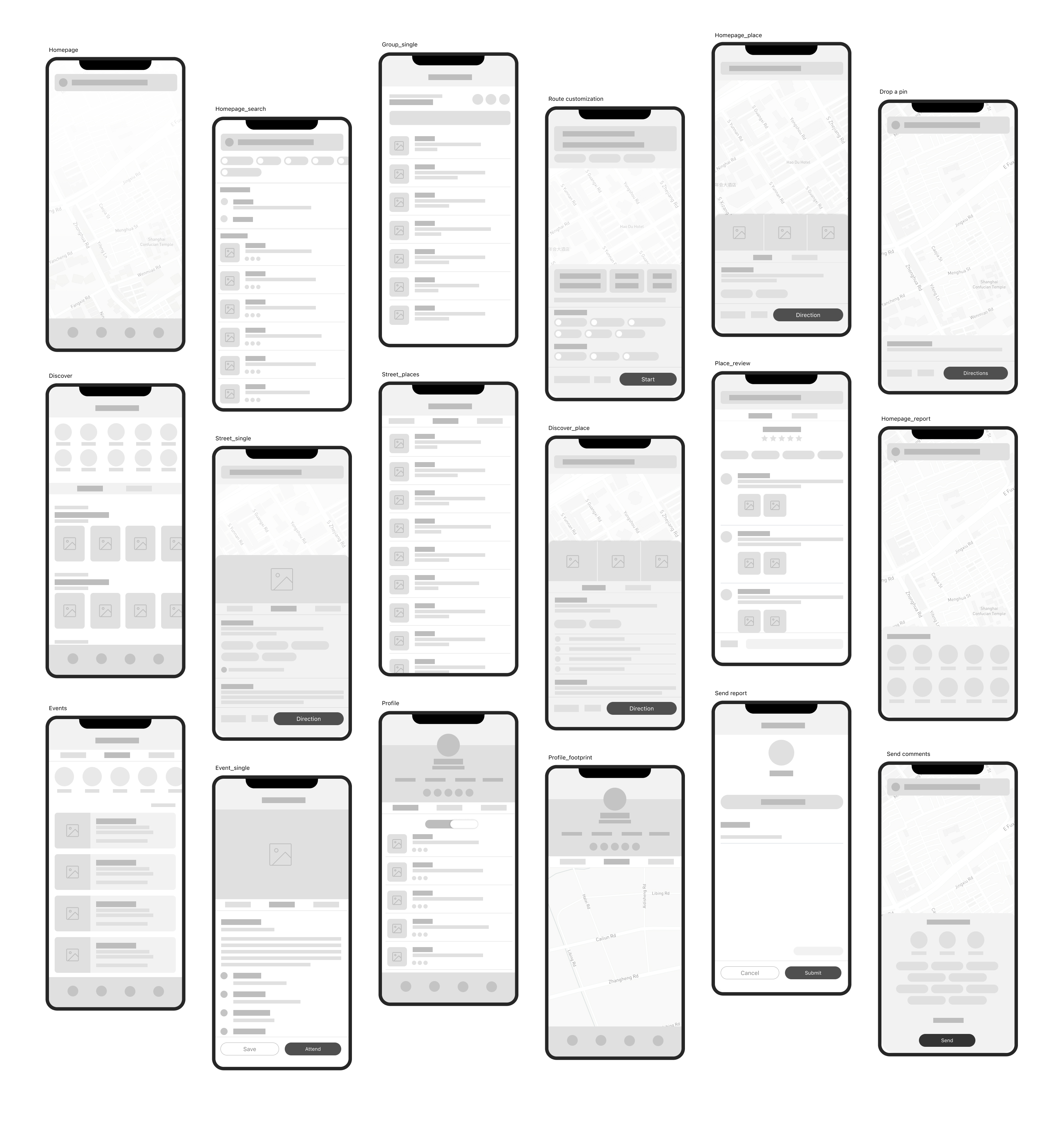
Wireframes
After discussions on the design system including color, text, button and layout, we developed the low fidelity wireframes and kept refining them until it reached the visual consistency in the information structures before diving into details.
Build personalized walking experiences
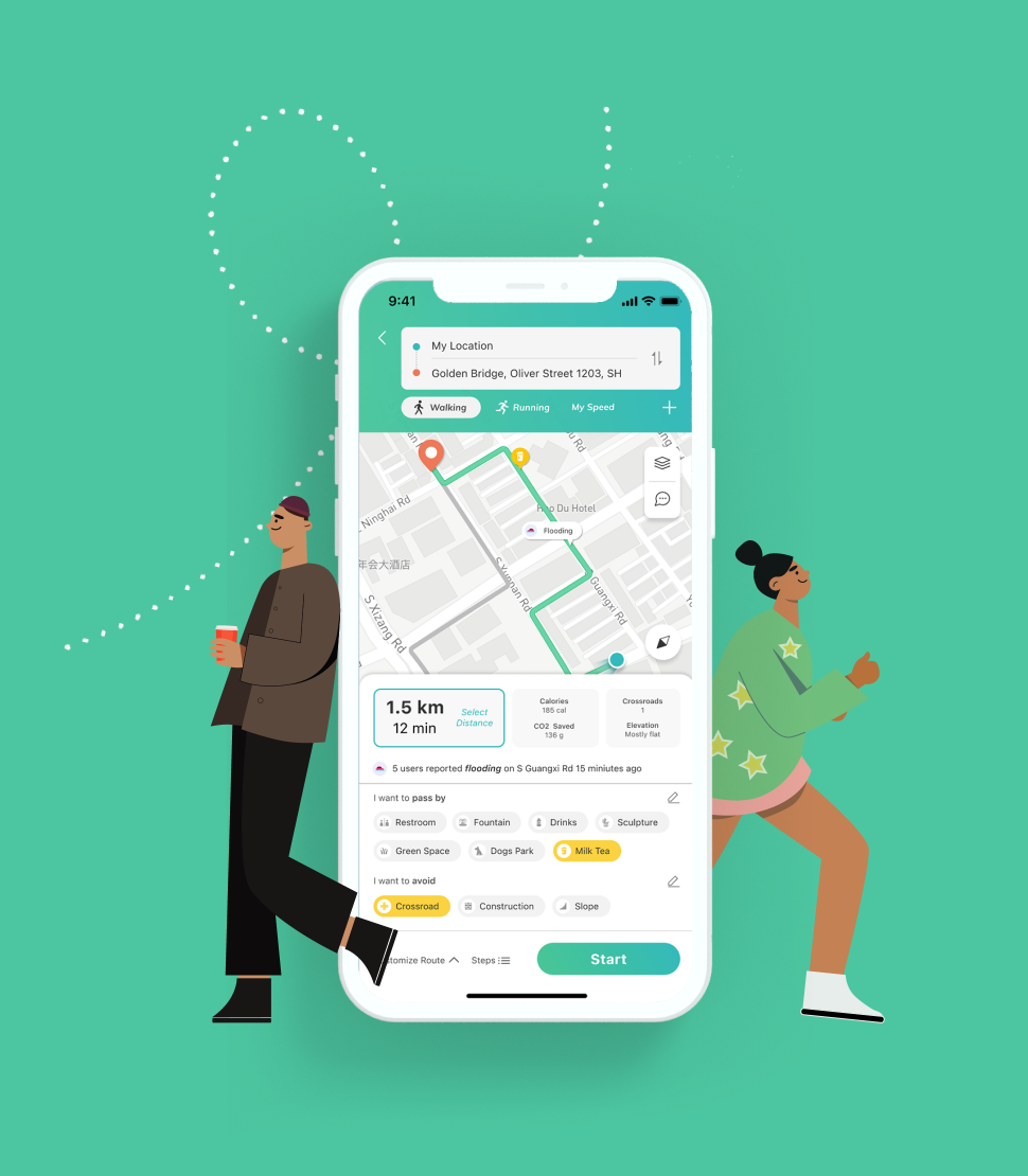
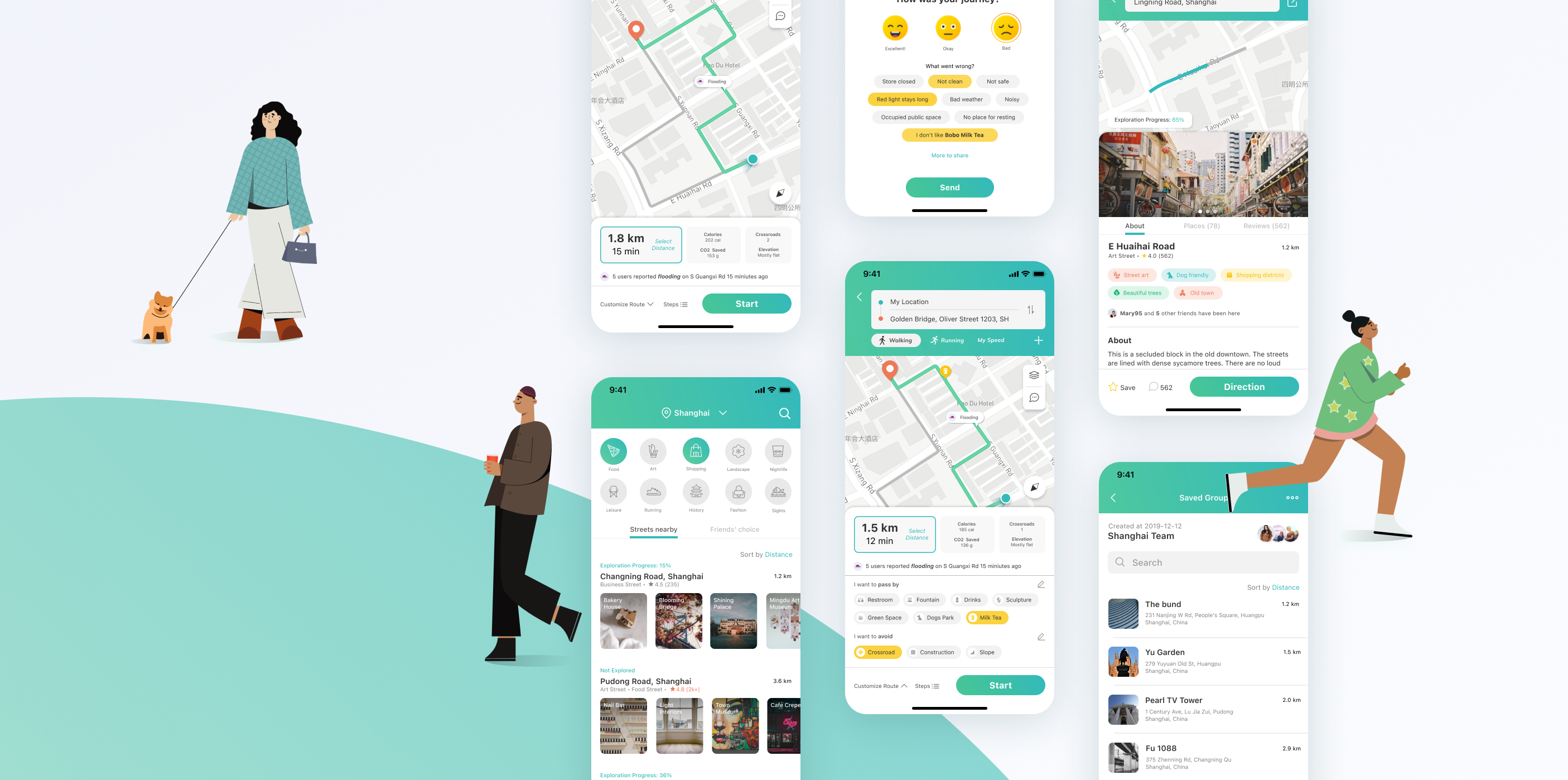
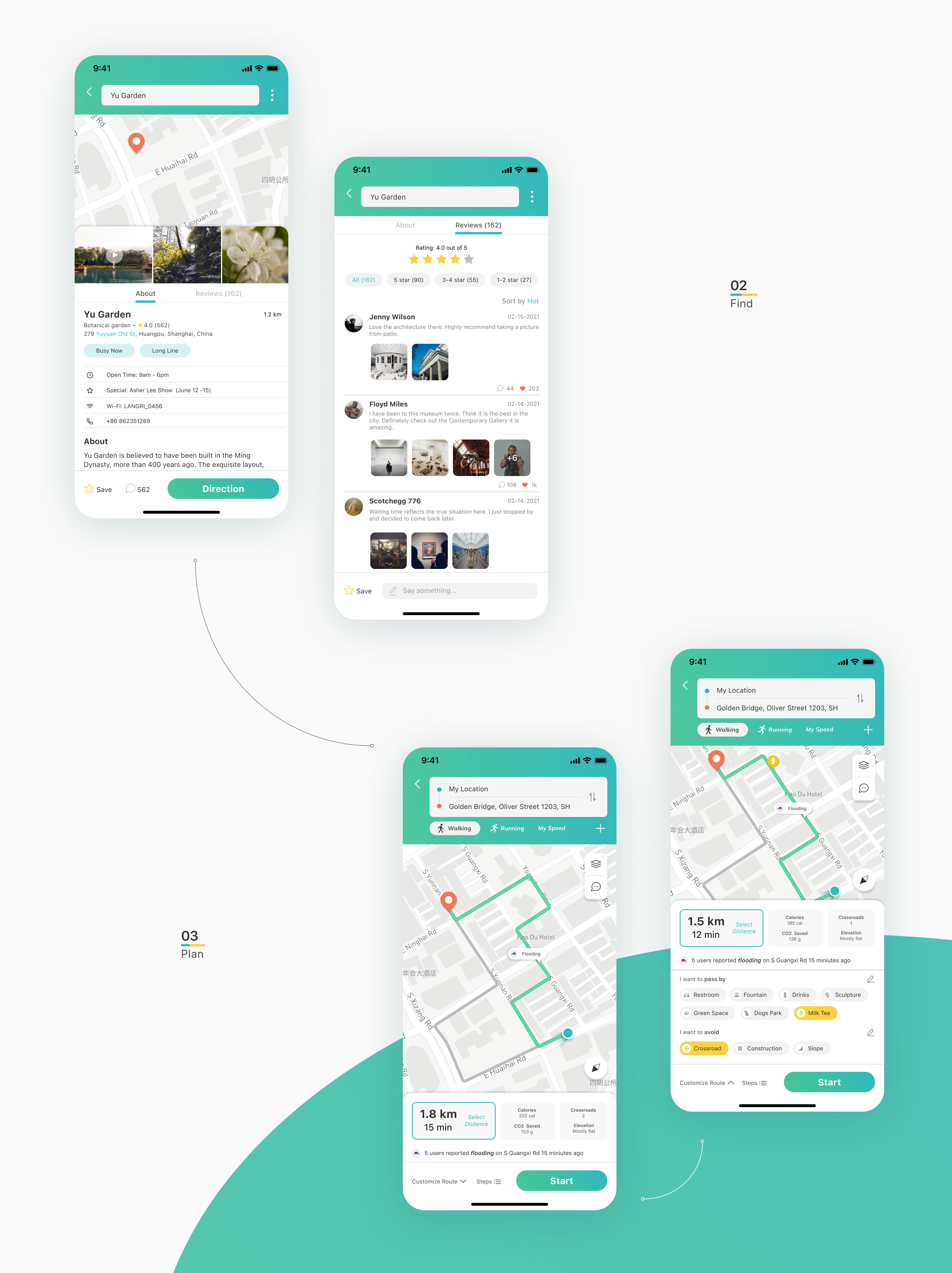
I created a series of high-fidelity prototype screens, dealing primarily with the main navigation and street exploration features. A normal navigation map is displayed at the homepage. When users press the search box, it will list the sections of quick navigation, search history and saved group, reducing the time for entering address. Among quick navigation options, there is an option of back to the current location, which is specifically designed for users who goes running outside. The saved groups collect the places users have saved before. The group feature supports collaborative work with friends in the app, collecting interested places in the same folder.
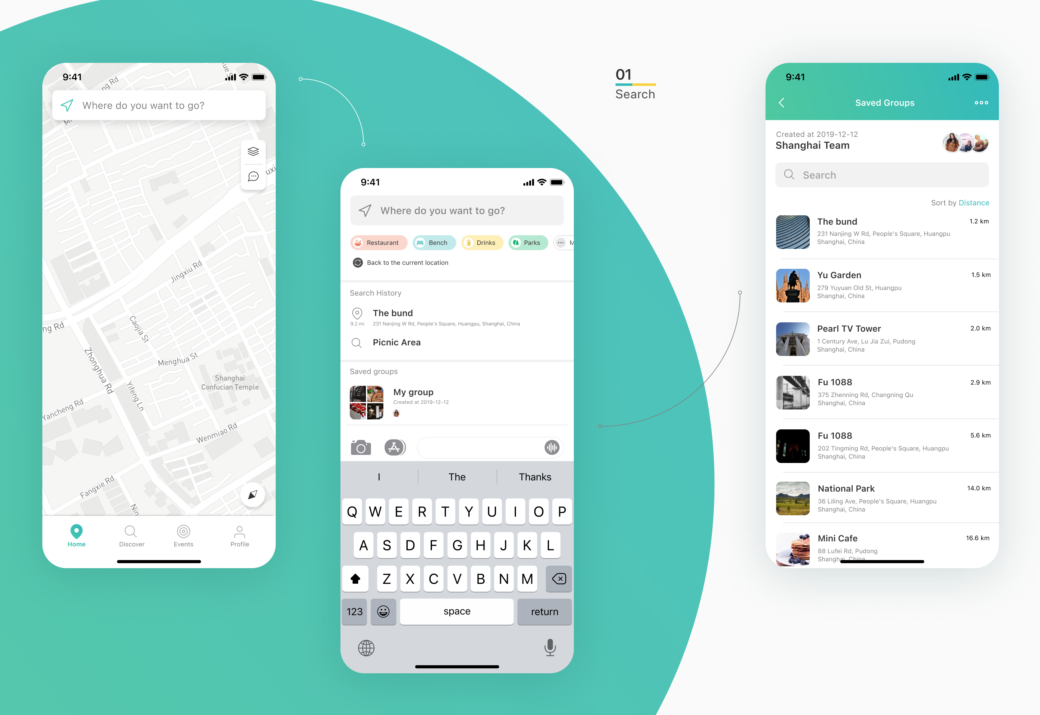
Route planning is the most important step before the walking activities. Since this app is not for the purpose of commuting, the distance adjustment is a significant feature that differentiate this app with other efficiency-periodized apps. Combine with the quick navigation option of back to the current location, distance adjustment enables users to select a preferable walking/running distance.
Walking navigation will use different metrics to inform users what will the walking experiences be like except time and distance. The counted calories, saved carbon, crossroads passed by and the elevation profile are also highlighted in this app to make the walking experience predictable. Unexpected road condition relies on the instant reports from other users, notify the current user to pay attention to these conditions.
To breakdown the walking indexes and data of urban+ into the strategies to meet user’s scenario-based needs, we design the feature of further route customization. Inspired from users’ interview, we allow users to set preferences by selecting the type of places/streets they want to pass by or avoid. For example, through selecting “I want to pass by green space”, go street will recommend a route that have highest score of landscape index.
Report and evaluation system
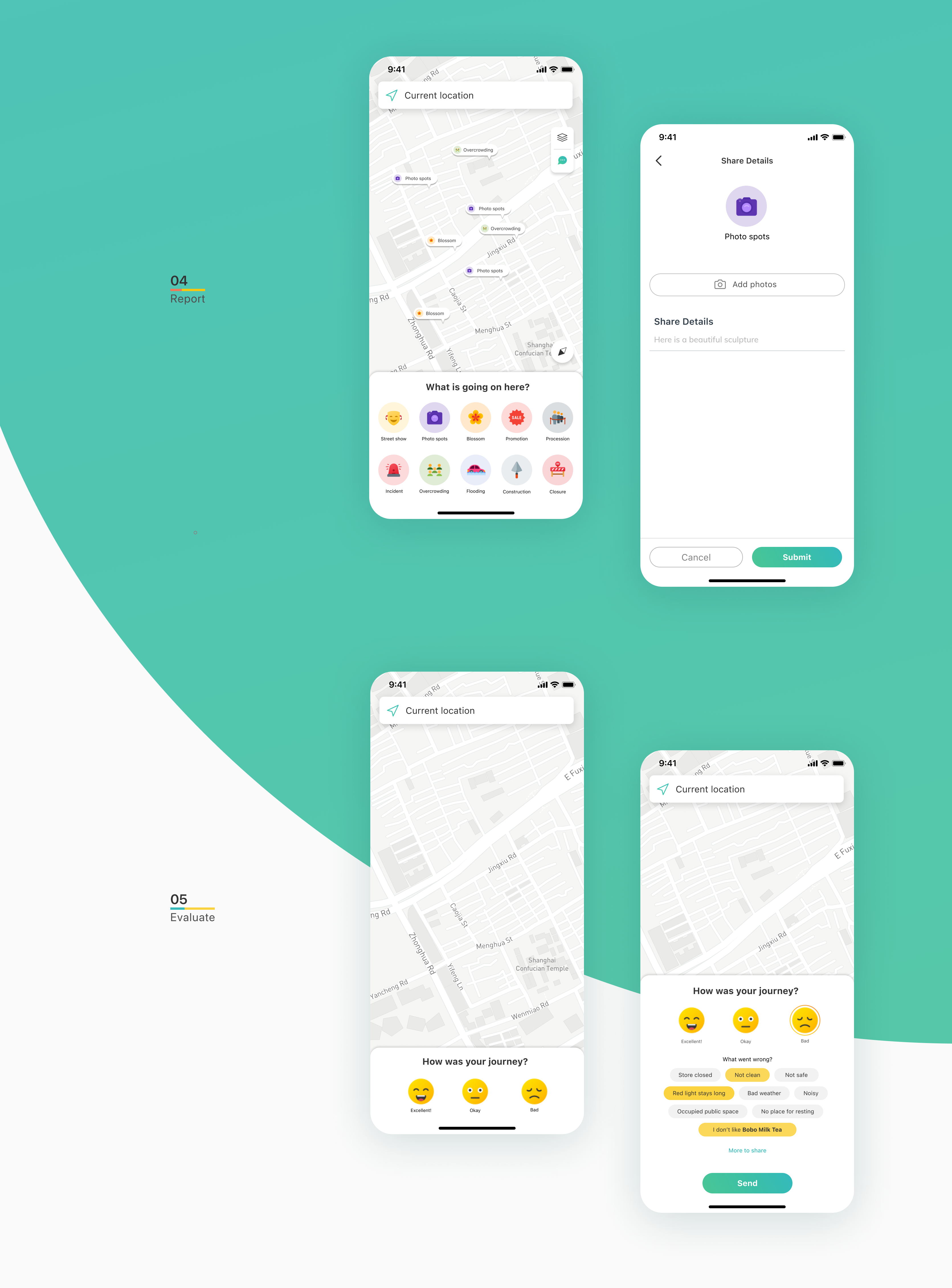
Users can use the dialog icon on the map to report what they see on their way. To limit the contents in the ranges of instant conditions that will change overtime, the app provide the categories that users can report about. When other users find the situation disappear, they can uncheck these icons on map.
The previous rating system designed by urban+ is to ask users directly rating on the six-index metrics while users are large likely not able to comprehend these concepts and not really care about some of them when walking in streets. To get more effective and valuable feedbacks, we occasionally pop up the review window and invite users to share their feelings after finishing the navigation. To make the process less disturbing, we provided options of high potential reasons that users might think of. Also, the options will change based on the selections users set in the route customization feature. In this way, we speak users’ language and receive feedbacks on the things they largely value along the way.
Street-based community
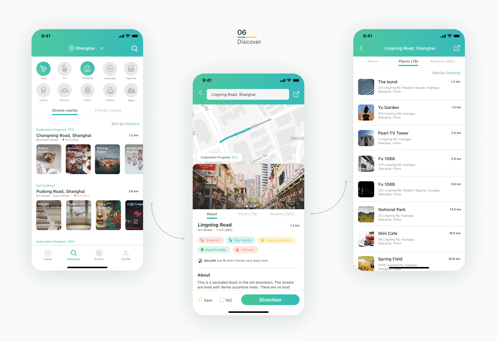
Urban+ expect to sell their strategies through recommending streets due to their efforts on the index scorings, while it is actually not matching the existing place-oriented mental model of users. We brainstormed to design strategies to make users adapt to the street-unit recommendation but still provide enough drives. On the Discover page, we list the street categories first to inspire users what types of street they can explore. The single street card is composite of street information and recommended places in horizontal scrolling containers so users can still view the places at the first glance and make more convinced decision if need to look further.
The street page is composited of an interactive map showing the exploration progress on the top with a drawer containing street information at the bottom. The keywords associated with the street is another “breakdown” process of the street index system, translating them into phrases that will be more attractive to users. These keywords are also important to the recommendation algorithm through content-based collaborative filtering, helping users find the streets they highly preferred quickly.
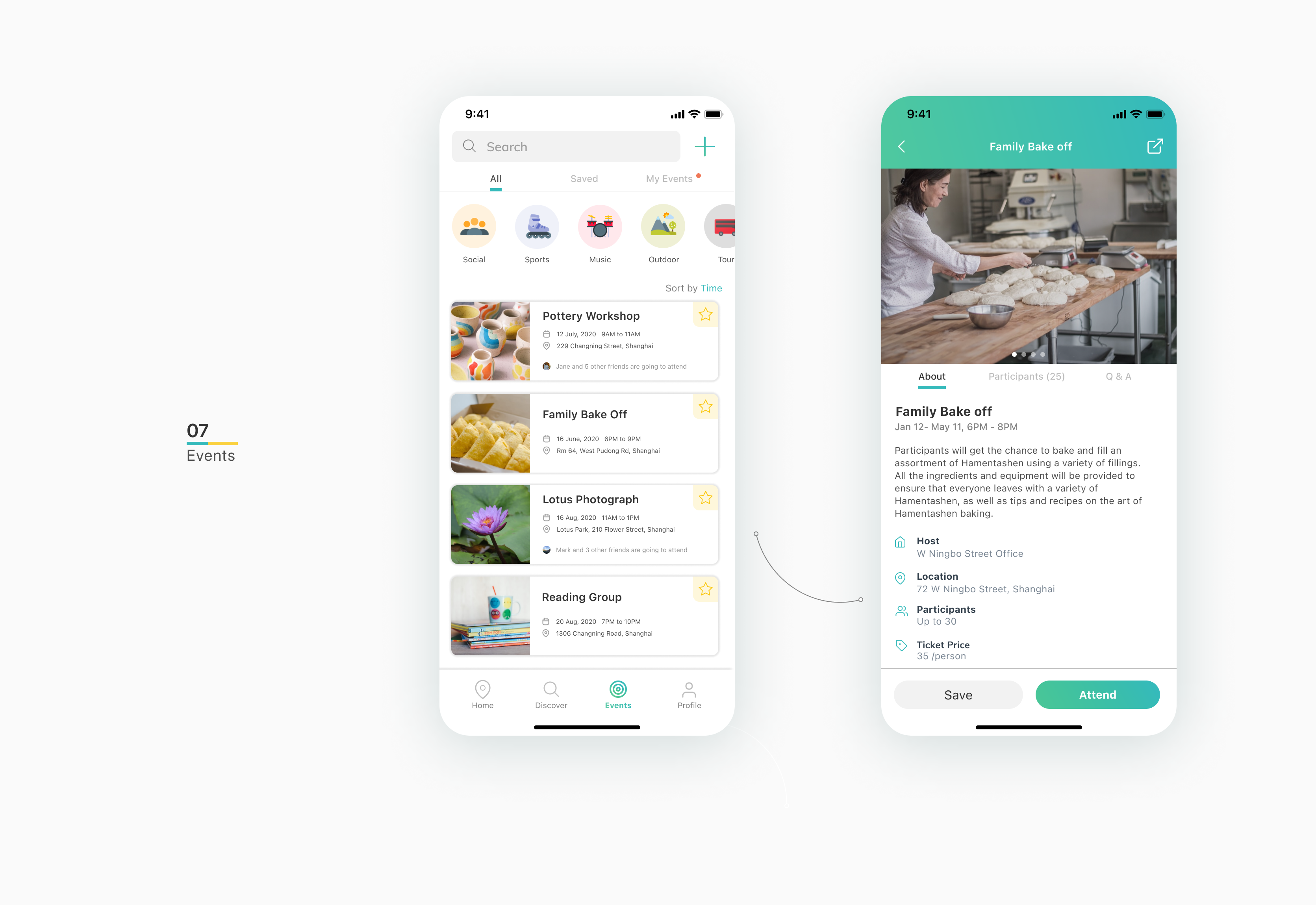
Events page is for users to explore the nearby events and attend these events to make friends. In the initial period of after releasing the app, the street administrative sectors will have the free access to create events and attract nearby users, eventually building an online-to-offline friend circle within neighborhoods.
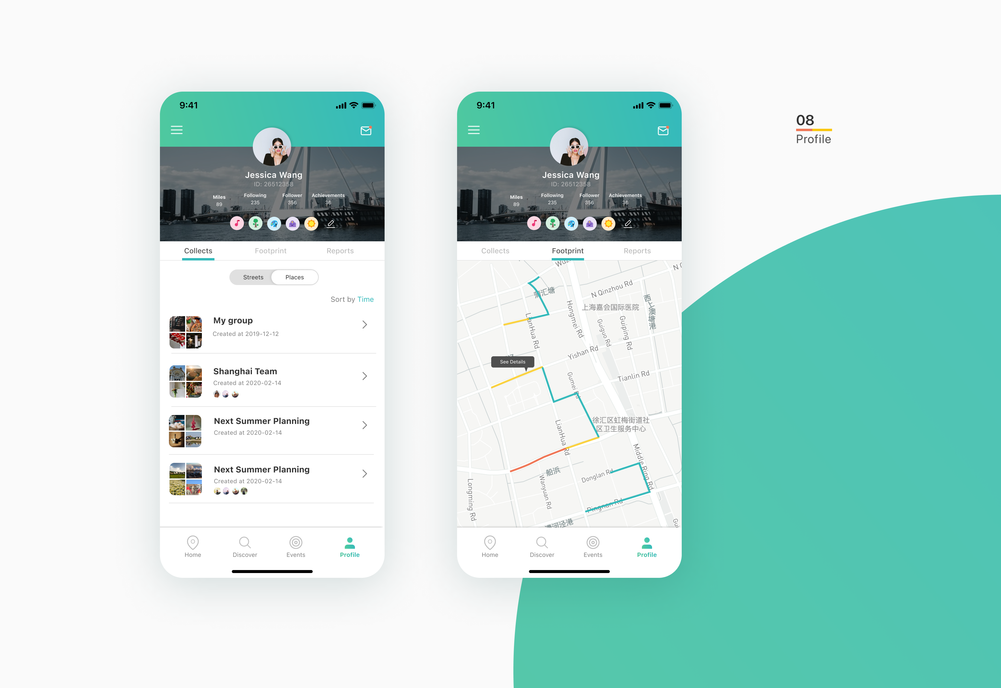
Profile information
The counted miles, historical footprint and periodical reports are viewable in the profile page. Users can display the badges they earn from the achieves on the banner of profile.
In the final rounds of integrations, we keep updating our design by collecting feedbacks from users and stakeholders. Following are minor changes that we address to make the experience better, they are: